Metal Detecting Around Historic Sillamäe
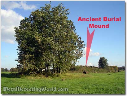
Discovering An Ancient Burial Mound
Overall, it was a successful hunt considering the fact that someone had already searched the site before me and still left some "goodies," and that the site was heavily littered with junk. My mind was already preoccupied with thoughts about metal detecting the second site of a homestead that I discovered on the old map and which was not as easy to access as this one.
I wishfully thought of a possibility of discovering a "virgin" site. Though, from my previous experiences I had learned that, in most cases, the remote sites would turn out to be "hammered" by other metaldetectorists even more than the obvious ones.
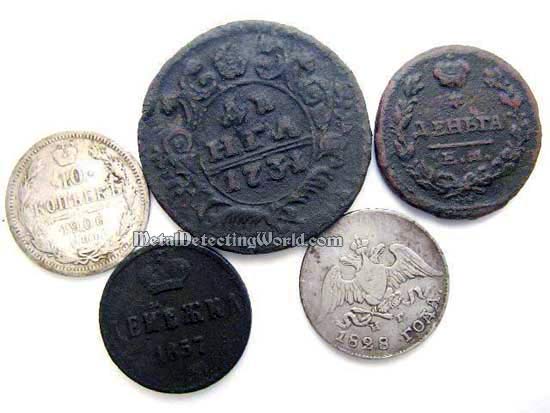
Cool Finds of the Day
The next few days were rainy and cold and I stayed indoors. As soon as the weather improved, my fellow treasure hunter Ingvar came from Tallinn for one day of metal detecting. He wanted to search the site, which he discovered on the old map, where a small Swedish church (Kirka) used to stand.
I told Ingvar about the homestead site I had been thinking about. He pulled an old map out of his pocket, and while we were looking for the spot on the map, we discovered a rampart situated near the site. On a map, there was a mark, two swords crossed, for a skirmish site, located in the field east off the military earthwork. Next to the mark there was a date - 1700, and an inscription which we could not decipher.
A Fragment of the Old Map
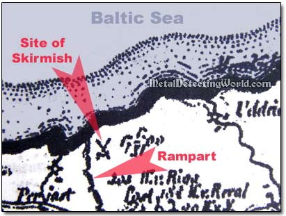
If it was indeed a skirmish, then it occurred between the Russian forces of Peter I and the Army of Swedish King Carl XII during the Great Northern War. The symbol of two swords crossed also could commemorate the beginning of the rampart construction.
In the old history book, I found the following information: "The earthwork was built by the Russians during the Great Nordic War (1700 - 1721) to block off the Swedes. The half-circle defense line started from the seaside, crossed over the Sinimäed (Blue Mountains) and reached up to the swampy area in the east near Aluvere."
We made a plan: first, to check out the Kirka site, then metal detect at the skirmish site, on both sides of rampart, and try to locate the old homestead site if we had time left. That was plenty to do in one day.
Ingvar came with his car so it took us only 10 minutes to get to the Kirka site. Unfortunately, instead of an old foundation in the field, we discovered a huge sand-pit at the spot. Ingvar suggested me to check the adjacent field.
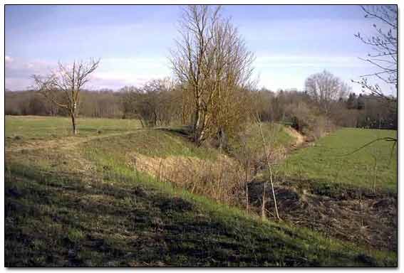
We searched it for two hours and found nothing but a few fired rifle shells casings. We drove back towards the seashore, and easily found an access road to the skirmish site, a huge field used by local farmers for hey growing. The rampart, still in tact, ran across the entire field.
Rampart Built By Army of Czar Peter the Great In 1700
According to the map, the skirmish took place in the North-Western corner of the field. To our disappointment, that spot was off limits as we noticed an archaeological plaque placed on a pole standing in a small group of trees.
Next to the grove, there was a huge mound - an ancient burial barrow, circa II AD. Even though the archaeological plaque was written in Estonian language, we understood that this spot was protected by the State and was off limits.